

What is lidar technology? If you’ve worked in surveying, engineering, telecom, or infrastructure, you’ve probably heard the term LiDAR. Over the last few years, LiDAR technology has become one of the most reliable ways to capture highly accurate spatial data. From mapping highways to inspecting power lines, it allows organisations to collect millions of measurements in a fraction of the time required by traditional surveying methods.
But what is LiDAR, how does it actually work, and why has it become such an important part of modern LiDAR mapping and mobile LiDAR survey projects?
What Is LiDAR Technology?
LiDAR stands for Light Detection and Ranging. It is a remote sensing technology that uses laser pulses to measure distances between a sensor and surrounding objects.
As the laser scans the environment, it records millions of measurement points. These points are combined to create an accurate three-dimensional representation of roads, buildings, vegetation, utilities, and other infrastructure.
Unlike standard photography, LiDAR captures precise measurements rather than just visual images, making it ideal for engineering and mapping applications.
How Does LiDAR Mapping Work?
The process behind LiDAR scanning is straightforward but incredibly powerful.
A LiDAR sensor rapidly emits thousands, or even millions, of laser pulses every second. Each pulse travels to an object, reflects back to the sensor, and measures the time it takes to return.
Using this information, the system calculates the exact distance to each object.
When combined with high-accuracy GNSS receivers and Inertial Measurement Units (IMUs), the result is a detailed 3D point cloud that accurately represents the real world.
Most professional LiDAR mapping systems also include high-resolution cameras, allowing imagery and laser data to be captured simultaneously.
What Is LiDAR Used For?
Today, LiDAR technology is used across a wide range of industries where accurate spatial data is essential.
Some of the most common applications include:
- Road and highway mapping
- Telecom network planning
- Utility asset inventories
- Railway corridor surveys
- City and municipal mapping
- Flood modelling
- Forestry analysis
- Construction and engineering projects
- Digital twin creation
- Infrastructure inspections
Because LiDAR captures millions of accurate measurements, organisations can make better decisions without relying solely on manual field surveys.
What Is LiDAR Mapping?
LiDAR mapping is the process of using laser scanning data to create detailed maps and 3D models of the physical environment.
Unlike traditional mapping methods, LiDAR captures both horizontal and vertical information with exceptional accuracy.
The collected data can be processed into:
- 3D point clouds
- Digital Terrain Models (DTMs)
- Digital Surface Models (DSMs)
- Contour maps
- Road inventories
- Asset databases
- Engineering models
These outputs help engineers, planners, and asset managers work with reliable data throughout the lifecycle of a project.
What Is a Mobile LiDAR Survey?
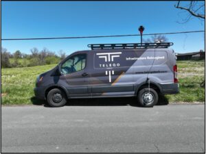
A mobile LiDAR survey involves mounting LiDAR sensors, cameras, GNSS receivers, and IMUs onto a moving vehicle.
As the vehicle travels along roads or infrastructure corridors, it captures continuous spatial data without interrupting traffic or requiring lengthy road closures.
Compared with conventional surveying, a mobile LiDAR survey offers several advantages:
- Faster mobile data collection
- Reduced field time
- Improved worker safety
- Highly accurate measurements
- Detailed street-level imagery
- Minimal disruption to road users
This makes mobile mapping services particularly valuable for transportation, telecom, utilities, and local government projects.
Why LiDAR Is Better Than Traditional Surveys
Traditional surveying remains useful for many applications, but large infrastructure projects often require a faster and more comprehensive approach.
With LiDAR scanning, organisations can capture entire corridors in a single survey while collecting millions of measurements every second.
This provides:
- Better coverage
- Higher efficiency
- Greater accuracy
- Faster project delivery
- Richer datasets for future analysis
Rather than returning to site multiple times, teams can revisit the captured data digitally whenever new measurements or inspections are required.
Choosing the Right LiDAR Solution
Not every project requires the same type of LiDAR system.
Factors such as project size, required accuracy, terrain, and deliverables should all be considered before selecting a solution.
Professional providers combine advanced LiDAR sensors with precise positioning systems, calibrated cameras, and experienced data processing teams to ensure reliable results.
Choosing an experienced mapping partner helps reduce project risk while improving data quality.
Final Thoughts
Understanding what LiDAR is is the first step towards appreciating how modern mapping has evolved. Whether you’re planning a transport corridor, inspecting infrastructure, or managing utility assets, LiDAR technology provides the speed, accuracy, and detail needed for informed decision-making.
At Teleqo Tech, we deliver advanced LiDAR mapping and mobile LiDAR survey solutions that help organizations capture accurate geospatial data with confidence. By combining industry-leading technology with experienced professionals, we support infrastructure, telecom, transportation, and government projects across every stage of the mapping process.