TELECOMMUNICATIONS MAPPING & ASSET MANAGEMENT SOLUTIONS

Improve telecom infrastructure with mobile LiDAR, 360° imagery, GIS asset inventories, & fiber network mapping solutions from Teleqo Tech.
Decorative branding lines graphic

TELECOMMUNICATIONS MAPPING & ASSET MANAGEMENT SOLUTIONS

Build Smarter Networks with Accurate Geospatial Intelligence

Modern telecommunications networks depend on accurate infrastructure data. From expanding fiber broadband to maintaining utility poles, cell towers, and outside plant assets, every decision starts with knowing exactly what exists in the field.

Teleqo Tech helps telecommunications providers, broadband operators, engineering firms, and network contractors capture, manage, and visualize infrastructure using high-accuracy mobile LiDAR, 360° street-level imagery, GIS-ready asset inventories, and cloud-based visualization platforms.

Our end-to-end mobile mapping solutions reduce costly field visits, accelerate engineering workflows, and provide the reliable infrastructure intelligence needed to plan, build, and maintain modern telecommunications networks.

Decorative top left branding graphic

TELECOMMUNICATIONS INFRASTRUCTURE IS BECOMING MORE COMPLEX

The rapid expansion of fiber broadband, 5G deployments, and utility infrastructure has created new challenges for telecommunications organizations. Engineering teams need reliable data to support network planning, while operations teams require accurate asset inventories to maintain existing infrastructure.

Unfortunately, many organizations still rely on outdated records, manual inspections, disconnected GIS databases, and repeated field visits that increase project costs and delay deployment schedules.

Without current infrastructure data, even routine engineering decisions can become expensive and time consuming.

COMMON INDUSTRY CHALLENGES

Mobile mapping captures millions of data points, but the real value lies in extracting meaningful information about specific assets and features. Teleqo Tech employs experienced GIS analysts and purpose-built software to deliver accurate, comprehensive asset inventories from LiDAR and imagery data.
Teleqo Tech branding logo
HOW TELEQO TECH HELPS

HOW TELEQO TECH HELPS TELECOMMUNICATIONS ORGANIZATIONS

Teleqo Tech delivers comprehensive mobile mapping services that transform physical infrastructure into accurate digital assets.

Using advanced mobile LiDAR systems, synchronized 360° imagery, and proven geospatial workflows, we collect, extract, validate, and visualize infrastructure information that supports every stage of the asset lifecycle.

Whether you’re planning new fiber routes, documenting utility poles, supporting make-ready engineering, or maintaining existing telecommunications infrastructure, our solutions provide the reliable spatial intelligence your teams need to work faster and make informed decisions.

Decorative bottom right branding graphic

SOLUTIONS FOR

TELECOMMUNICATIONS

SOLUTIONS FOR TELECOMMUNICATIONS
Teleqo Tech radar technology visualization
Mobile LiDAR Data Collection

Capture high-density LiDAR point clouds & immersive 360° imagery across thousands of miles with centimeter-level accuracy. Mobile mapping dramatically reduces field collection time while creating a permanent digital record of your infrastructure.

Utility Pole Inventory

Create comprehensive utility pole inventories including ownership, condition, attachments, clearances, GPS locations, and structural characteristics to support engineering, permitting, and maintenance.

Roadside Asset Inventorying

Document ground infrastructure within the right of way for fiber designs. Asset attribution, typing and condition assessments provide the level of detail needed for accurate engineering.

Vegetation Encroachment Analysis

Perform in depth analysis on risk zones for vegetation around poles and spans, which is delivered in shape files and comprehensive reports.

Cloud-Based Visualization

Give engineering, operations, and management teams secure access to mobile mapping data through intuitive cloud-based visualization platforms that eliminate unnecessary site visits.

GIS Consulting

Our experienced geospatial professionals help organizations improve infrastructure management, data quality, GIS workflows, and long-term asset strategies.

Decorative branding lines graphic
Decorative bottom right branding graphic

TELECOMMUNICATIONS USE CASES

Teleqo Tech supports a wide range of telecommunications initiatives, including:
WHY MOBILE MAPPING

WHY MOBILE MAPPING CHANGES EVERYTHING

Traditional infrastructure surveys often require repeated field visits, manual measurements, and separate inspection teams.

Mobile mapping captures millions of highly accurate data points while simultaneously collecting immersive street-level imagery, creating a permanent digital representation of your infrastructure corridor.

This allows engineers, planners, GIS specialists, and decision makers to perform measurements, inspections, and asset verification directly from their desktops without repeatedly returning to the field.

The result is faster project delivery, lower operational costs, improved worker safety, and more confident decision making.
Decorative bottom right branding graphic
BENEFITS FOR TELECOMMUNICATIONS

Benefits for Telecommunications Organizations

Teleqo Tech map camera and survey equipment graphic
Faster Network Planning

Reliable infrastructure data helps engineering teams design and validate projects with greater confidence.

Fewer Field Visits

Access detailed LiDAR and 360° imagery remotely to reduce unnecessary site inspections.

Better Asset Visibility

Maintain accurate GIS inventories that improve maintenance planning and infrastructure management.

Improved Decision Making

High-quality geospatial data supports engineering, permitting, budgeting, and long-term capital planning.

Scalable Infrastructure Intelligence

Capture and manage thousands of miles of network assets using repeatable workflows designed for enterprise-scale projects.

Decorative bottom right branding graphic
WHY CHOOSE

Why Choose Teleqo Tech

Founded

0

Miles of LiDAR & imagery data

0

Assets

0

Teleqo Tech combines advanced mobile mapping technology with experienced geospatial professionals to deliver dependable infrastructure intelligence for telecommunications organizations.

Since 2020, we’ve captured more than 50,000 miles of mobile LiDAR and imagery data across North and South America and extracted over one million infrastructure assets using rigorous quality assurance processes.

Our team delivers complete solutions—from field data collection and GIS-ready asset extraction to cloud visualization and consulting—helping organizations streamline operations, reduce project risk, and make better infrastructure decisions.

Whether you’re supporting broadband expansion, network modernization, or utility pole management, Teleqo Tech provides the accuracy, speed, and expertise needed to move projects forward with confidence.

REQUEST A QUOTE

Provide details about your project and we’ll respond with a detailed proposal:

OUR CASE STUDIES

Discover how our geospatial expertise, mobile LiDAR technology, and accurate data solutions help organisations plan, manage, and deliver infrastructure projects more efficiently.
network_mapping_building
Broadband Network Mapping for a Regional Telecom Provider
A regional telecom provider needed accurate mapping of utility poles and fibre routes before expanding its broadband network. Our mobile LiDAR and data extraction team captured high-quality infrastructure data, reducing manual site visits and helping engineers plan deployments with greater confidence and speed.
highway_roads_map
Highway Asset Inventory for Transportation Planning
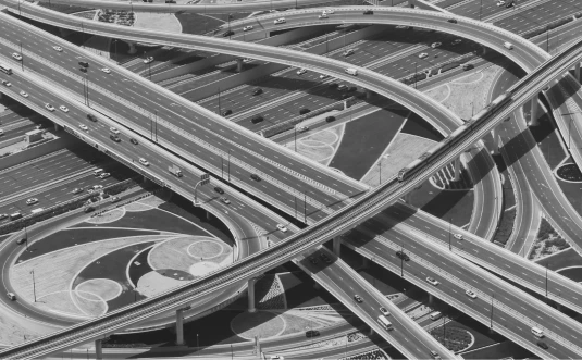
A transportation agency required a detailed inventory of roadside assets across multiple highway corridors. Using advanced mobile mapping technology, we delivered accurate LiDAR data and GIS-ready asset information, enabling faster maintenance planning and more informed infrastructure decisions.

INDUSTRIES THAT BENEFIT

Although this page focuses on telecommunications, our mobile mapping solutions also support:
Transportation agencies
Electric utilities
Municipal governments
Smart city initiatives
Infrastructure
engineering firms

FREQUENTLY ASKED QUESTIONS

What is telecommunications asset management?
Telecommunications asset management is the process of documenting, maintaining, and monitoring infrastructure such as utility poles, fiber networks, cabinets, and communication equipment throughout their lifecycle.
LiDAR is generally cost-effective because it dramatically reduces survey time and labor costs compared to traditional ground-based methods.
Mobile mapping is the process of collecting geospatial data using vehicle-mounted sensors as they travel along roads and corridors. Our systems combine LiDAR (Light Detection and Ranging) technology with high-resolution 360° cameras to capture detailed 3D information about infrastructure and the built environment. This allows you to remotely assess assets, measure conditions, and plan projects without extensive field visits.
We primarily serve three key sectors: telecommunications companies who need to inventory poles and assess attachment capacity, state/city departments of transportation who conduct corridor assessments and sign inventories, and utility companies who map distribution networks and monitor vegetation encroachment. Our services are designed for any organization that manages physical infrastructure across large geographic areas.
Our expert extraction team delivers up to 97% accuracy with 95% confidence across all asset types. We achieve this through a combination of advanced sensor technology, proprietary workflows, and rigorous quality assurance processes. Every project undergoes systematic validation to ensure the data meets our accuracy standards before delivery.
We use state-of-the-art RIEGL LiDAR systems, which are industry-leading sensors known for their precision and point cloud density. These are paired with high-resolution Ladybug 6 360° imagery systems that capture panoramic photographs synchronized with the LiDAR data, providing both geometric accuracy and visual context for every location.

BUILD SMARTER TELECOMMUNICATIONS NETWORKS

From utility pole inventories and fiber network mapping to mobile LiDAR and cloud-based visualization, Teleqo Tech helps telecommunications organizations make faster, data-driven infrastructure decisions.
Decorative branding lines graphic

More Detail