Make your mobile mapping data accessible and actionable with intuitive cloud-based visualization tools that eliminate barriers between field data and decision makers.
DATA VISUALIZATION
SEEING IS
UNDERSTANDING:
The most accurate geospatial data in the world is only valuable if your team can access it, understand it, and act on it.
Teleqo Technical Solutions provides powerful visualization platforms that transform complex 3D point clouds and panoramic imagery into intuitive interfaces anyone can use.
Cloud-hosted visualization platform for exploring mobile mapping data directly from your web browser—no special software required.
Key Capabilities:
Seamless navigation through 360° panoramic imagery
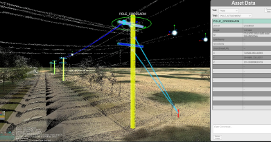
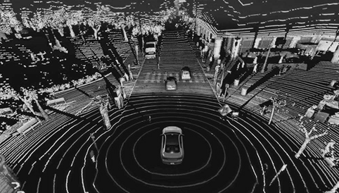
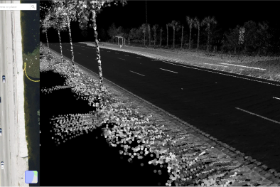
Integrated LiDAR point cloud viewing
3D Measurement and annotation tools
Multi-user collaboration
Role-based access control
Pathfinder enables your team to:
Conduct remote site assessments
Verify field conditions before deployment
Coordinate across distributed teams
Document pre-construction conditions
Reduce field visits and associated costs
Use Cases
Across Industries
01
Telecommunications
Planning
Network planners can remotely assess pole capacity, identify attachment opportunities, and plan fiber routes without multiple site visits. Engineering teams can verify make-ready work and document existing conditions.
02
Transportation
Asset Management
State and local DOTs can inventory and assess transportation assets, conduct corridor studies, and monitor change over time. Traffic engineers can evaluate sight distance and analyze crash locations remotely.
03
Utility Network
Management
Utility companies can document infrastructure conditions, plan maintenance activities, and coordinate multi-utility projects. Engineering teams can verify clearances and assess vegetation management needs.
PLATFORM BENEFITS
PLATFORM BENEFITS
Zero Infrastructure Requirements
Cloud-hosted solution accessible from any modern web browser, eliminating the need for expensive workstations or specialized software.
Instant Access
Your team starts working with data immediately upon project completion—no download, installation, or configuration required.
Collaboration Built In
Share views, measurements, and annotations across your organization with granular permission controls.
Always Current
As we collect new data in your project areas, updated imagery and LiDAR automatically become available in the platform.
Scalable Licensing
From departmental pilots to enterprise-wide deployments, our flexible licensing accommodates organizations of any size.
NEW COMPASS
POWERED BY
NEW COMPASS TECHNOLOGY
Teleqo’s visualization services are delivered through New Compass Pathfinder, the platform we developed to support our own operations and now offer commercially through New Compass Solutions. When you work with Teleqo for visualization, you benefit from the same tools our team relies on daily.